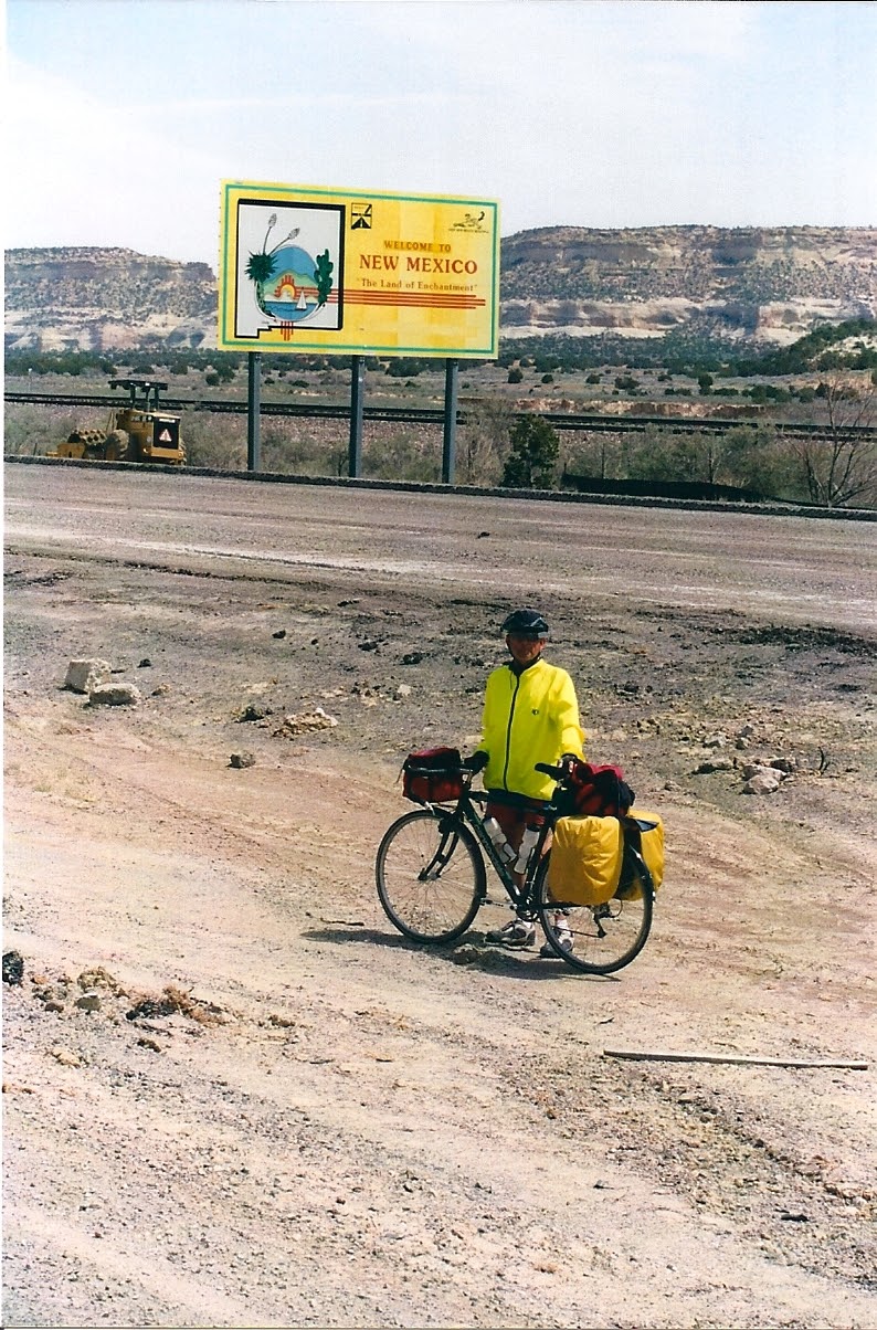
New Mexico has more miles of Route 66 than any other state. We rode 508 miles. The state has changed it’s laws which now allow bicycles to use the Interstate, if needed. Some of the signs that prohibit bike are still there but we just ignored them. The few times that we used the Interstate we had no problems with the law. There are places where you have no choice but to use the Interstate. I heard that before the law was changed riders just rode the Interstate and took their chances. Most of the time they had no problems since the police knew that they had no choice. We also reached our highest elevation of 7,500 feet at Glorieta Pass, just east of Santa Fe.
The first half of New Mexico, where Route 66 crosses the state, is in the mountains and we will be above 5,000 feet. The second half, from Santa Rosa to the Texas border we will drop to an elevations in the 4,200 foot range.
(4-10 Gallup) After checking into our motel we headed into downtown. The first stop was the a bike shop to check for a Route 66 bike jersey. The bike guy, this was a multi-outdoor sports store, said he had none but he had some left-over T-shirt from the “Route 66 Bike Classic” and we could each have one for free. He went into the back and came back with two from the 5th annual classic which was held in 1996. This was a race type event. The picture on the front was a serious bike racer with the Route 66 logo in the back ground. They are very nice T-shirts. He also offered to check over our bikes for free. We thanked him for the shirts but said no thanks to the free checkup. Neither of us have been having any trouble with our bikes.
We continued to tour the town and found a very nice old hotel, the famous “El Rancho Motel.” This hotel was the, on-location, home to movie stars like Tracy and Hepburn, Bogart, Hayworth, Flynn, and Peck. We should have ridden into town to check out this place first instead of taking the first place we came to. Gallup, is known as the Indian jewelry capital of the world.
(4-11 Grants) Today it was warm by 11 AM. We started our climb towards the Continental Divide, some 27 miles away. We stopped for lunch at a gas station/snack bar. We both had taco’s for lunch. A few miles down the road David began to feel sick. As we reach the Continental Divide, 7,263 feet, David was SICK. He christened the divide like it has never been christened before. The rest of the way to Grants was very hard for David. We made several stops for him to rest. He was very dizzy and had a fever. How he tough it out only he knows.
Pulling into Grants we found a motel and David took a rest. I was feeling good so I went for a ride around town. As we headed for dinner I began feeling sick, not as bad a David but never-the-less SICK. It was a hard night for the both of us. When morning came we decided to spend a second day in Grants as we both felt to sick to ride. We will never be sure just what made us sick, but since we both ate the same thing for lunch, and our sickness was like food poisoning, we think it could had been our lunch. I do not remember the exact location of where we ate, all I can tell you is not to stop to eat between Gallup and the Continental Divide. I know for sure it was not the restaurant at the Divide.
(4-12 Grants) SICK, just stayed put in the motel.
Navajo rancher Paddy Martinez’s curiosity about the odd yellow rock he found on Haystack Mountain about 10 miles west of Grants had far-reaching effects. The rock was uranium and within months of the day he happened upon it in 1950, Grants was transformed from a farming community to a mining town. The area proved to be one of the largest uranium reserves in the world.
(4-13 Albuquerque) David was still not feeling very good, while I am not 100% I do feel better. It would be a hard 84 miles to Albuquerque. On the good side we went from 6,460 feet to 5,000 feet. Due to not feeling well we skipped the section of Route 66 that goes through Los Lunas and instead headed straight into Albuquerque, still on Route 66 (both roads were Route 66).
Some months before we left on this great adventure I had written to each of the 8 states that Route 66 crosses, asking for Route 66 information and the status of riding on the Interstate where you have no other choice. I got an answer to my letter to New Mexico from Dianne, a state worker, she said that New Mexico had changed the law which now allows bicycle on the Interstate. She also offered to let us stay at her house. I must say it’s always very nice to stay with locals in their home. As the time for our departure drew near I e-mail her telling her the approximate date of our arrival. She answered back, saying that she had just gotten married and she was now living with her new husband, Jon, in his house but we could still stay in her house which she still owns. By the way we hit the date right on the nose.
The Sunday afternoon ride across Albuquerque on Central Ave. was NO FUN. Traffic was heavy, there was no shoulder for bikes and there was no parking lane. So we had to ride in a traffic lane which ticked off some drivers. We crossed the Rio Grand river, which was like a muddy stream and headed the 9 or so miles up hill to the far east side of town where Dianne’s house was.
Dianne was there waiting for us as we rode up. She showed us around the house and we made plans for going to dinner together. We ate at a Chinese buffet, and for the first time David and I did not do justice to the buffet. We were still not feeling 100%. Among other sports Dianne and Jon are “High Pointers.” Meaning they climb to the highest point in each state. Jon has climb to the highest point in 34 states while Dianne has reach the high point in 32 states. I would like to thank them both for a wonderful evening and for putting us up.
Along the way people have been telling us about the “Turquoise Trail”, which runs between Albuquerque and Sante Fe. So for the first time we would detour from Route 66 and take this trail. Also David has a friend, Janda from his collage days, who lives in Santa Fe. She told us about a good place to eat lunch in the town of Madrid which is about half way to Santa Fe. Besides if we had taken Route 66 a good part of the route is Interstate 25.
(4-14 Santa Fe) We said our goodby’s to Dianne who had come over to the house to see us off. David was still not 100% but I felt pretty good. After a quick bagel breakfast at Einstein Bros and a short visit from Dianne who brought me my REI travel towel that I had left at the house it was on to the Turquoise Trail.
The Turquoise Trail runs on the back side of Sandia Crest, 10,678 feet, which is the ski resort area for Albuquerque. So we ventured off Route 66 and the Interstate and onto the Turquoise Trail National Scenic Byway This scenic and historic area encompasses 15,000 square miles in the heart of central New Mexico. We would ride back in history going through the mining towns of Golden, Madrid and Cerrillos. Yes, it was UP hill, we would climb 2,000 feet. But, it sure was beautify country. Pulling into Madrid we stopped for lunch at The Mine Shaft Tavern, recommended by Janda. This tavern is described as “Ethnographically Irresistible, One of the last great road houses.” No question, if you are ever in the area, it’s a must stop.
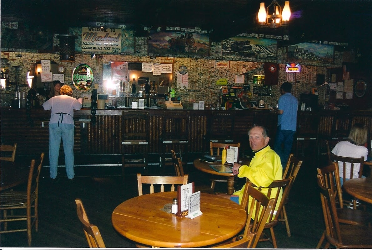
We had just sat down to order when Janda, walked in to join us for lunch. She had driven down from Santa Fe. I had a big burger which was very good but turned out to be very bad for me. I began feeling sick again. Later, I would find out that eating beef was just the wrong thing to do when you are trying to get over food poisoning. After lunch it was back on the bikes and continue uphill to Santa Fe.
Some info about this towns in this area:
Madrid: the rich history of this town dates from the early 1800's and has taken it from the discovery of coal and a mining town, to today’s distinctive artist’s community. Because of the unique geology of the area, a phenomenon found in only two other mines in the world, hard and soft coal were both mined here with shafts as deep as 2500 feet.
Golden: this area was the site of the first gold rush west of the Mississippi, 1825.
Cerrillos: this areas turquoise and lead deposits were critical to the jewelry and pottery making of the prehistoric Indians and the mines influenced Spanish settlement. Turquoise mined here found its way to the crown jewels of Spain.
After checking in to our motel I headed to the local bike shop to have my free-hub lub. It was beginning to bind when I back pedaled. Not a show stopper but more of a nuisance. When I called the shop they told me there was no way of helping me since their backlog was over a week. After telling them that I was on the road and had no time to wait for a week they said come on in and they would see what they could do. When I reach the shop I was welcomed with open arms and they took my bike right in. JC Walker, the service mgr, worked on my bike and did a great job, thanks JC, the bike rode like new.
After dinner we returned to the motel where we watched the Weather Cannel, as we often did most nights. The forecast for tomorrow was not good. High winds with rain, hail, and snow was forecasted. I, also began to feel really bad. David was also still not feeling good. It was decided that if we woke feeling bad we would just spend another day in Santa Fe.
(4-15 Santa Fe) I was up most of the night with a very bad stomach. I looked in the phone book to see if I could find a walk-in medical service. The only thing I found was that the local hospital, St. Vincent, took people on a first come basics in their emergency room. You had to be screen first and then, if accepted, you would be taken in-between emergencies. I hopped on the bus and headed for the hospital. Because I was on the road and pretty sick they took me. I got a Rx to kill the bug that had found a home in me as well they gave me two liters of water via IV. Plus the doctor told me to avoid beef for several days and eat bland foods. The whole process took 5 hours. Another reason I wanted to visit a doctor/hospital while on the road, was to try out of my insurance company’s out of area coverage. To see just how well my insurance would cover me. It worked great. The total bill from the hospital was $688.83, which my insurance paid all but for $50, my co-pay when out of the coverage area. My insurance company is Kaiser.
(4-16 Las Vegas - New Mexico) Breakfast was oatmeal, apple juice and a banana. David also ate the food that was suggested by the doctor. It was 31 degrees out winds to 25mph. On the good side most of the time this would be a tailwind. David, as he does so good, lead us across town on back streets to were we could get back on Route 66. We climbed from 7,000 feet to out high point of the trip at Glorieta Pass which is at 7,500 feet. We had some great down hills with a good tailwind before having to climb back up to 6,371 feet at Las Vegas, our overnight.
But first we rode through the town of Pecos where we crossed the Pecos River. After a snack we bought a jar of peanut butter and a loaf of bread for tomorrow’s ride, we would have over 60 miles of NOTHING not even water. Both of us were beginning to feel much better.
As we entered Las Vegas we started to checkout motels. We spotted “The Historic El Fidel Hotel.” Just for the fun we went in to we checked out the price and found it to be equal to the other motels in town. They were a little concern about letting us take our bikes into the room, but after some reassuring they said OK. This is one of those wonderful old hotels, 1920s, with squeaky wooden floors and a large lobby. Our room, while not large, was very nice and comfortable.
(4-17 Santa Rosa) The forecast was for rain and strong winds. It did not rain and the wind was in the afternoon and not so strong. It was cold but the first 40 miles was fun and fast as we dropped out of the mountains and into the high prairie. This 40 miles was one of those great stretches where the miles just fly by. The next 20 miles, to where we met up with I-40, was a grind. There were rolling hills that seemed to never end and the wind was in our faces.
At the junction with I-40 we made use of our bread and peanut butter. Yes, it taste great. This was the longest stretch of road with no food or for that matter water. I would guess if you were not prepared at all, you could climb over one of the many locked gates and walk up the long dirt road to the house and hope someone was home to help you. Of course every locked gate had “No Trespassing” signs on it. As well some had a dog or two that seemed to say “No Trespassing” with their bark as we rode by. We were prepared with food and water.
Rolling into Santa Rosa we had planned to find a motel in the old downtown part of town. But, due to construction on the main road, which made it very dusty, we chose to ride on. Most of these Route 66 towns have a great old downtown and a more modern section which is usually along side the Interstate. We found a Motel 6 near I-40.
Santa Rosa is know as the “City of Natural Lakes.” Imagine scuba diving in the desert. Well that is just what you can do at the”Blue Hole.” The famous “Blue Hole” is a geological phenomenon. The natural, bell-shaped pool is 80 feet deep, and has astonishing clarity and a constant water temperature of 64 degrees. The diameter is 80 feet at the top and 130 feet at the bottom. The water is recycled every 6 hours with a flow of 3,000 gallons per minute.
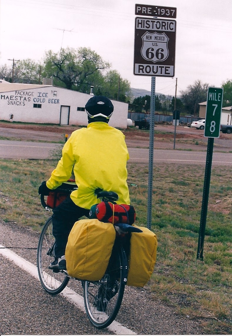
In 1930, the Santa Rosa section of Route 66 was opened. In 1937 Route 66 was re-alined and in 1972, I-40 was opened. Route 66 was re-alined several times over the years and that is why there are so many bits and pieces here and there. We always tried to ride on the oldest alinement.
We were told in Las Vegas to be sure not to miss “Bozo and Anna’s, Route 66 Auto Museum.” This museum was filled with restored cars and memorabilia. The owner gave us a two for the price of one discount, since we were on bike and riding Route 66. If you like beautify restored cars this place is a must and about half of them were for sale.
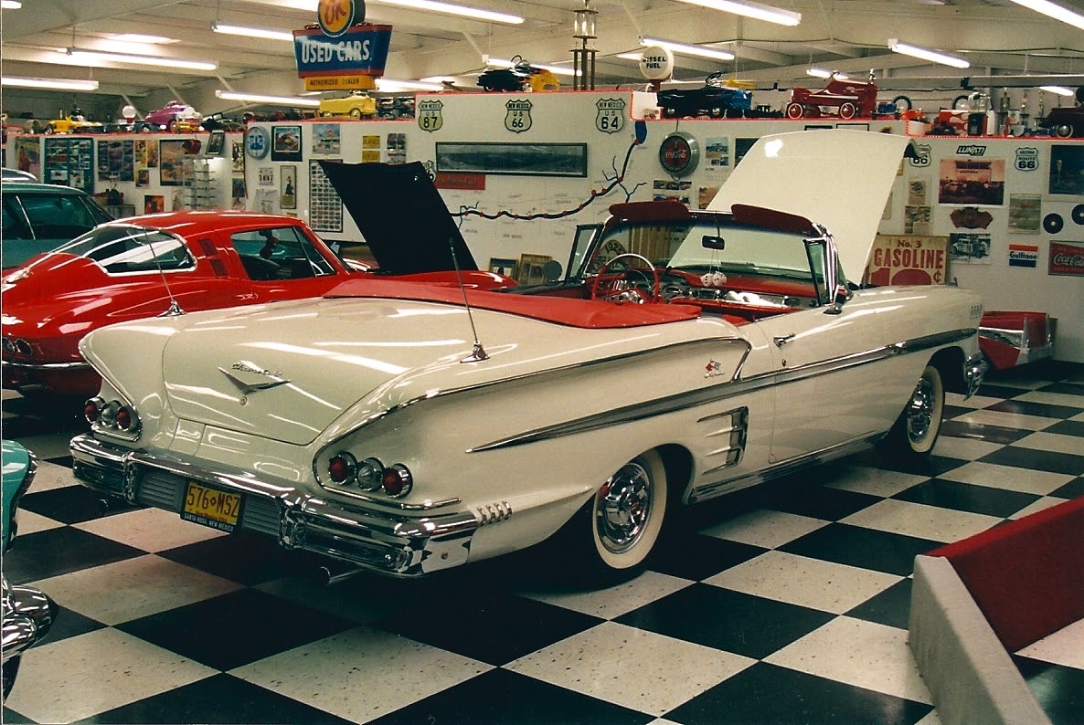
At dinner we returned to eating normal. I was feeling very good and David was feeling good. I must say there is nothing worse than being sick on the road. You just want to be home, in your PJ’s, in your bed, and have your dear wife taking care of you.
(4-18 Tucumcari) We woke to a sunny and cold morning with a VERY strong west wind. How great that was since we were heading east. In the package of stuff that the state of New Mexico sent me was a wonderful map of Route 66. The map showed that we leave Santa Rosa on Hwy 156 which is Route 66 for about 8 miles and then make a left turn to stay on Route 66 while Hwy 125 continued on straight. This would takes us towards I-40 where we could take Route 66 all the way to Tucumcari, except for about 6 miles on I-40.
With a great tailwind we were really flying down the road. At about 8 miles we did see a dirt road that headed to the left but it sure was not a paved road and look like it had a soft sandy surface, unfit for riding. So, on we rode. At 10 miles David, who has a nose for knowing that things could be going wrong, began to worry. Of course I told him not to worry as the map has been great so far. At 12 miles David again voiced his concerns. Again I said don’t worry as I see a string of power lines up ahead and I am sure that will be our left turn. Since we were flying, due to a strong tailwind before we knew it we had gone 18.8 miles and there was no left turn. At this point I had a flat tire, my first on any of our tours together. One flat in 9670 miles over four tours is not so bad. I yelled “flat” but David keep riding. He soon turned around and returned to where I was fixing the flat. He said he had ridden on to the crest of the small rise ahead, just a hundred feet or so, to see if he could see our left turn. He could not and in fact our road turns to dirt just over the rise.
With the flat fixed we were now face with the problem of having to ride back to Santa Rosa. Covering 18.8 miles back into this strong wind, now a headwind, would take 3 or 4 hours (especially for me). The day would be a lost day but what could we do. So we started to ride back. We talked about trying to flag down a car/truck and offer them $40 to take was back. But, since there was almost no traffic on this road that possibility seem far-out. About a mile down the road we spotted a rancher who was tending to his cows. While David tended our bikes I walked across the field to see if he would take us into town for a fee. I offered him $40 and he said “no, I have to take care of my cows.” His hired hand asked where we were heading and I told him Tucumcari. He told us that we need not ride all the way back to Santa Rosa and that we should take the next dirt road on our right, which was about 1.25 miles from here, this would take us over to I-40 and Route 66. It would be about a 5 mile ride on the dirt road. I thanked him and returned to tell David what I learned. Of course it will all depend on the condition of the dirt road as to how good his advice was.
By the way the hired hand did tell me that the dirt road we saw at about 8 miles was the road we were looking for but that the state has just let it deteriorate and besides the bridge was out so we could not have made it anyway. Of course the hired hand did not know what we have been able to get across with our bikes on passed tours.
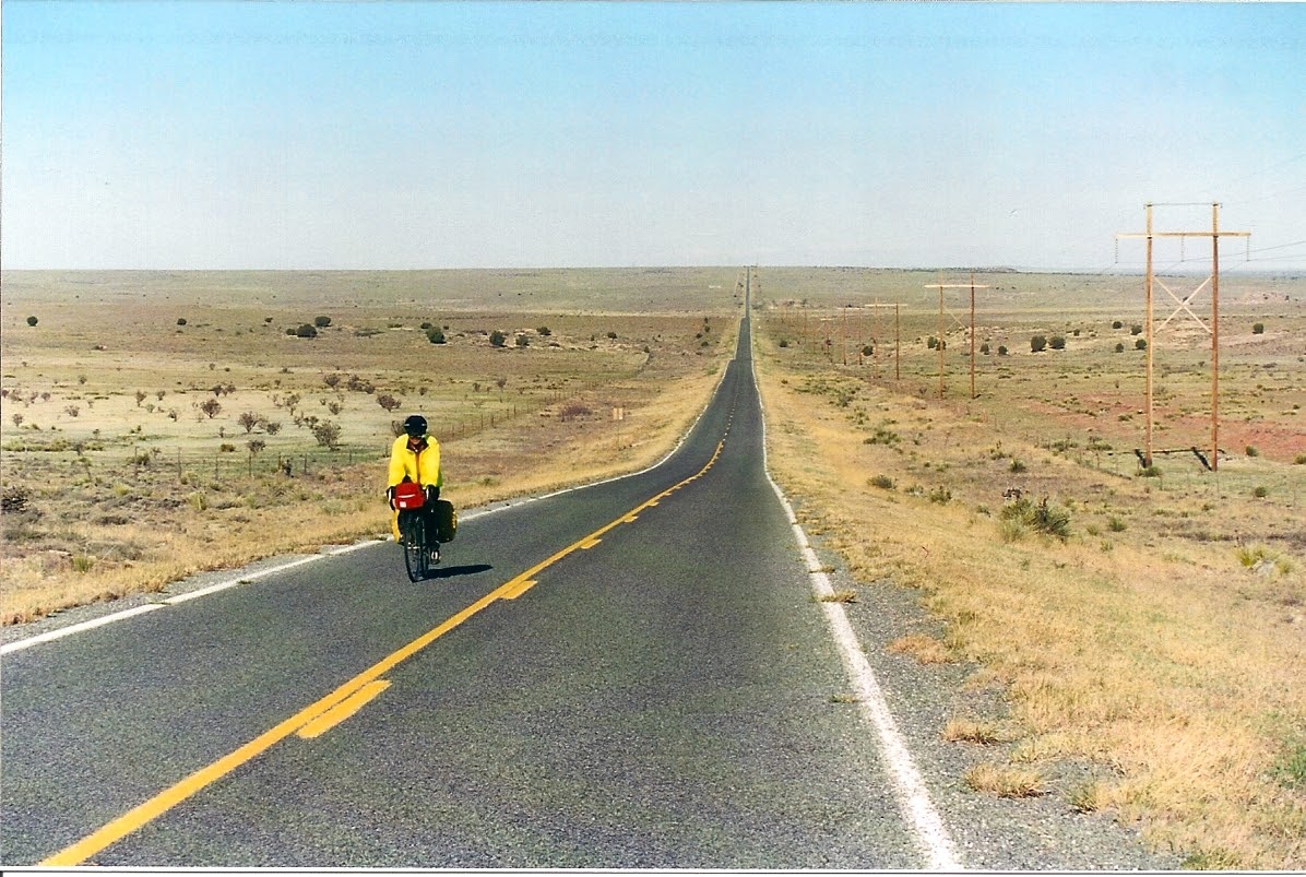
We made the right turn onto the dirt road and was very happy to see it was a hard packed clay road. The wind while still strong was now a side wind which we could deal with. While the surface was rough it was not soft or dusty. At 4.5 miles we reached the top of a rise and could see I-40 and Route 66, about half a mile below us. After high-fives, we covered the half mile and were on our way to Tucumcari. What could have been a very disappointing and hard day turned in to a great day.
It was a screaming ride, with the tailwind, into Tucumcari. Once in town we found 1935 motel (Americana Motel) and had dinner at a 1956 restaurant, “Roy’s Family Restaurant.” Have I said, life is good!
New Mexico was a difficult state. Lots of wind, hills, being sick, long scratches of endless roads, and more glass on the roads that any other state. But it’s all part of touring by bicycle.
Tomorrow we enter Texas our fourth state. We rode 515 miles with 13,780 feet of gain.