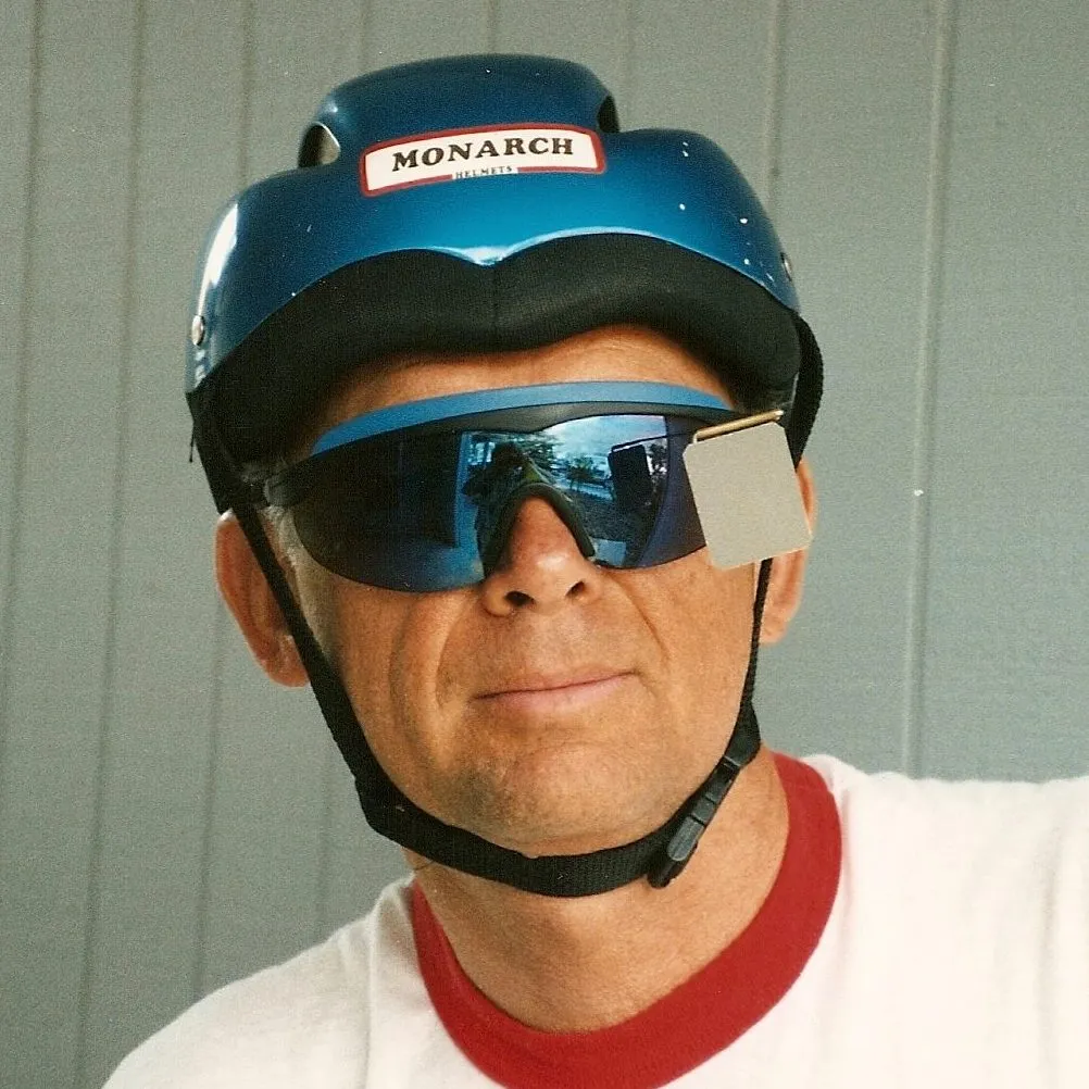
(4-3 Kingman) Yes, I woke with a full-blown common cold. This is the first time I have ever gotten sick on a tour. A common cold can’t be a stopper, so on the bike I got and rode across the Colorado River into Arizona. It was cool and cloudy. Since I-40 is Route 66 at this place, we decided to cut across town and take a lesser known bridge across the river thus avoiding the Interstate. It was a good move and soon we were on Route 66 to Oatman. We would climb over 3,000 feet to a elevation of 3652 feet at Sitgreaves Pass.
The road is paved but narrow, about 1.5 cars wide. On the good side was that traffic was very light. Breathing was difficult for me, but I just put the bike in low gear a ground it out. Up we climbed and soon signs of the town of Oatman was in sight. This was open desert with no cover and could be very hot later in the year.
Oatman, is a scene right out of the Old West. The town is loaded with gun-toting locals and camera-ridden tourists. Plus, of course, the omnipresent burros, who, will happily hustle you for a carrot, which are sold in town. The Oatman Hotel is on the National Register but is better known as the honeymoon hideaway of movie stars Clark Gable and Carole Lombard. Since it was noontime was decided to stop for lunch and then ride on to Kingman for the night.
We found a restaurant and asked for a glass of water while we decided what to order for lunch. We were informed that there is no water, only bottle water, for a price, as this the desert country. I order a BLT and an ice tea. The climb steepens after leaving Oatman, and the terrain becomes even more rugged. In the old days, when cars and trucks had little power, even in first gear, the only way up 3,000 foot grade was in reverse. Of course we had more gears on our bikes and the bikes were driven by one-man power. So up we went.
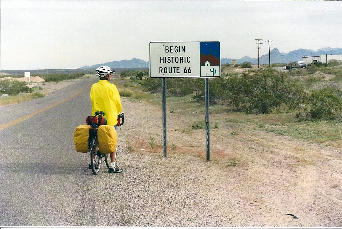
Route 66 is now a series of marvelous old switch-backs and blind cliff-hanging curves. Over the pass we rode, but we did not expect a great downhill that welcomed us, since Kingman is at 3,120 feet. Or I should say we hoped it would not be to much of a downhill. We seemed to be going down much more than we expected. Sure enough when we hit the bottom we could see Kingman across this valley and much higher than we were. We had dropped some 2,400 feet and had to climb back up 1,880 feet to Kingman. It was a slow and steady climb across a high desert valley. Kingman was some 16 miles away.
Note: I have several Route 66 reference books and maps. When I check them for info, such as the altitude of a place I get different numbers. Example: Kingman is lasted as any one of the following, 3120, 3328, 3334 or 3341. Not a problem, just interesting.
We found a motel and I crashed. It was a hard day for me, not being able to breath every good, so I just took a nap while David rode around town making a stop the Route 66 museum.
(4-4 Peach Springs) This would be an easy day. Or should I say it started out easy. My cold is still here. The worse of it would only last for another day but the runny nose would stick around for several weeks, this is most likely due to the cold weather as well as the cold.
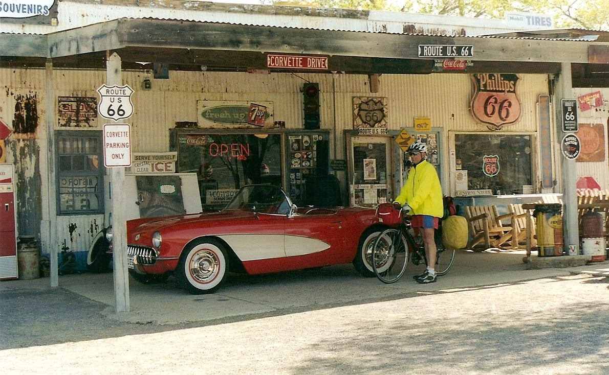
Just east of Kingman we crossed under I-40 and on to Route 66. From Kingman through Hackberry, Peach Springs, Seligman to Ashfork is one of the longest continuous scratches of Route 66. Soon there were hackberry bushes on both sides of the road so we knew that the town of Hackberry was not far off. If I thought the ideals and style of the ‘60s in America is dead, I was wrong. We found a special treat in Hackberry, a wonderful old store just full of Route 66 info and stuff. As well we found a very nice Red Corvette parked in front.
The wind began to pickup. It got stronger and stronger. Soon it was hitting us on our right side pushing us into the traffic lane. It was very difficult to keep the bike on the shoulder. Up a head we spotted a large green dinosaur and there was also motel. We took a quick vote and decided to call it a day. It was getting dangerous riding with the strong wind.
We are at 4,788 feet and in the town of Peach Springs home of the Grand Canyon Caverns. The motel was right on Route 66 and the Caverns were about one mile up a side road. The motel had a small market and Route 66 stuff. Along the way I have been looking for a Route 66 coffee cup. In the mini-mart there were several, most of which I had seem along the way. But, there was one that I really liked. I did not want to buy it and have to carry it all the rest of the way so I check to see if they would ship it home for me. Sure they would (I did get the feeling that they don’t ship items very often, since they had no idea of what to charge me). I just gave them an extra $5 and said put any change in the package, which they did. On one side of the cup is “I Traveled Route 66" and below this is the Route 66 logo. On the other side are the names of the eight starts that the road goes through. I must say that the coffee I have drank out of this cup , since being home, has tasted very good.
For dinner we rode the one mile up the road to the Caverns which had a restaurant. We were in luck as there was a large group of Elder Hostellers staying in the motel and eating at the restaurant, which meant tonight there was an all-you-can-eat buffet. If you are a cyclist you know how great an all-you-can-eat buffet is. We always made the most of these buffet’s.
(4-5 Williams) Overnight it got very cold and as we rode back up to the restaurant for breakfast there were a few snow flakes. The day stayed cold a cloudy with a light snow on and off all day. On the good side was that the wind was light. It was a steady climb, some 2,000 feet, to Williams (6,752 feet) our overnight for today.
Even through cold, it was a nice ride through the high desert with high Masa on each side of us. We made a stop at Seligman for a snack and to look at more Route 66 memorabilia. By the way the cup that I liked and bought at the Grand Canyon Caverns I never did see another one just like it or one that I like any better. Sometimes things just goes right.
Note: On October 13, 1984, the inevitable happened. The nearby 6-mile stretch of I-40 was officially opened. Williams had the distinction of being the last Route 66 town to be bypassed.
(4-6 Flagstaff) The overnight temp was in the teens and it was cold. Breakfast was at the “Route 66 Diner.” After breakfast it had warmed up to about 22 degrees. Our destination for today was Flagstaff which is at an elevation of 6,905 feet, but first we had to climbing over the “Arizona Divide” which is at 7,335 feet. It was a nice day with some tail wind and turning sunny in the afternoon.
After checking into the Youth Hostel we rode around town. Stopping at a bike shop we met “Hippie Jon”. He is an avid Mt. Biker and just loves this area. The reason for stopping, and we stopped at every bike shop we came across, was to see if we could find a Route 66 bike jersey. I even called bike shops in the places we stayed to see if they had a Route 66 bike jersey. I had no luck, most of the shops said they had never heard if one. Once in awhile a shop would say that there was one but that was many years ago. Yes, there were a lot of Route 66 T-shirts but we wanted a real bike jersey (you know the ones with pockets in the back). I just kept trying.
Hippie Jon told us about a restaurant for dinner, China Star, which has a “Super Buffet.” We asked the Warden (the person who runs the Youth Hostel) how far was the restaurant from the YH. He said 4 blocks, well that would be a very nice walk so off we went, on foot. What he did not say was that in this neck of the woods a block is about half-a-mile. So 2.25 mile later we sat down to dinner. I was not going to walk back (since my hip reconstruction walking is not that much fun) so I looked around to see it I could find a ride back. Since Flagstaff is a collage town I picked out what looked like a collage student and sat down to plead my case. He said sure, and soon all three of us were piled in the front seat of his small pickup truck. Sure beats walking especially after eating at a “all-you-can-eat” place.
(4-7 Winslow) Much to my surprise the Youth Hostel had a free continental breakfast. This would be a great day on the bike. While it was cool to start the sun was out, and it would warm up in the afternoon. We would go from 6,905 feet to 4,856 at Winslow our destination for today. We rode out of the mountain and on to the high desert.
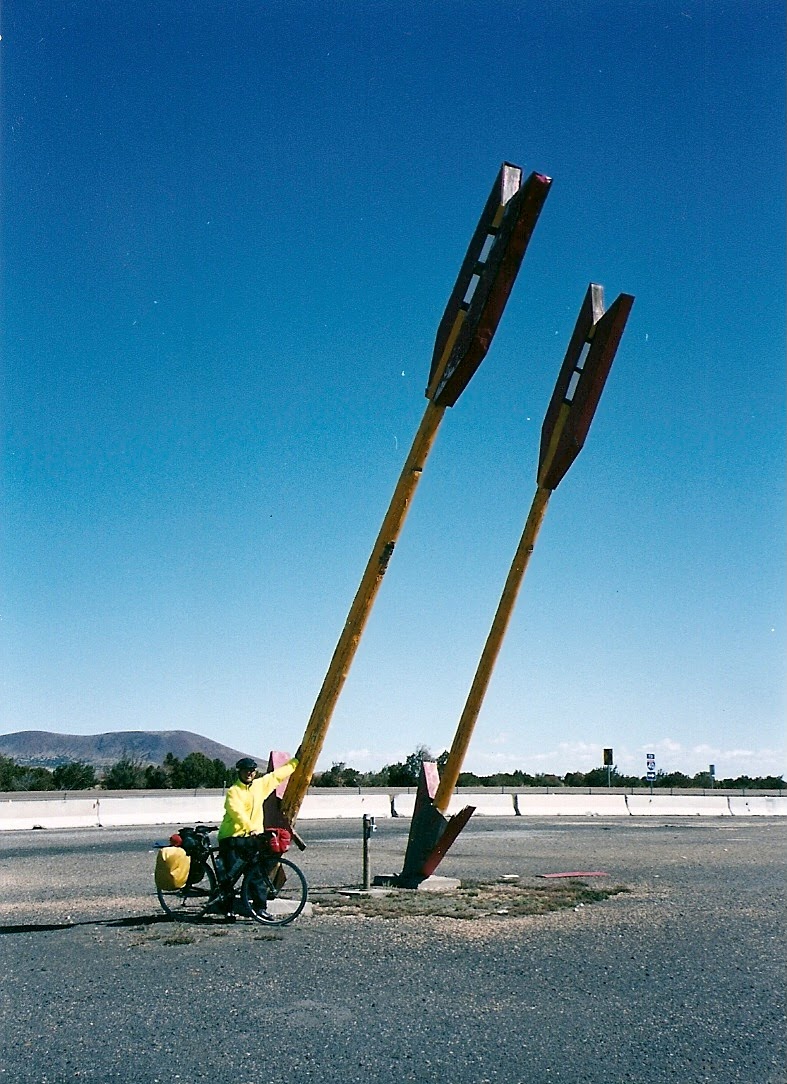
There in front of us was one of the most notable Route 66 landmarks, “Twin Arrows.” Once a famous stop for food and gas. Down the road was the least notable landmark “Two Guns.” There is not much left of either places. The Twin Arrows are still standing but everything else is closed and there are cement barricades keeping auto traffic for stopped (no problem for those on bicycles). Two Guns was also abandoned.
We were told that a Navajo Shaman had lifted the 1878 “Cave-of-Death” curse lurking over Two Guns and thus the Trading Post was reopened. From what I could see the curse must still be in affect as there was nothing open or even looked like it would be opening.
A planned side trip was to see “Meteor Crater.” Wow, what a hole in the ground. This crater is 550 feet deep, 4,100 feet across and over 2.5 miles in circumference. The crater is privately owned so the cost to see it was a little on the high side, $13. But, I must admit they have done a great job making the place attractive and interesting. The crater is billed as “The Best Preserved Meteorite Impact Site on Earth.” Besides the crater to see there is museum, rock shop, gift shop, and best of all a snack bar (really it was a Subway) and we were ready for lunch. Also there are guided rim tours and a theater showing a 10 minute movie “Collisions and Impacts.” All in all, well worth the stop.
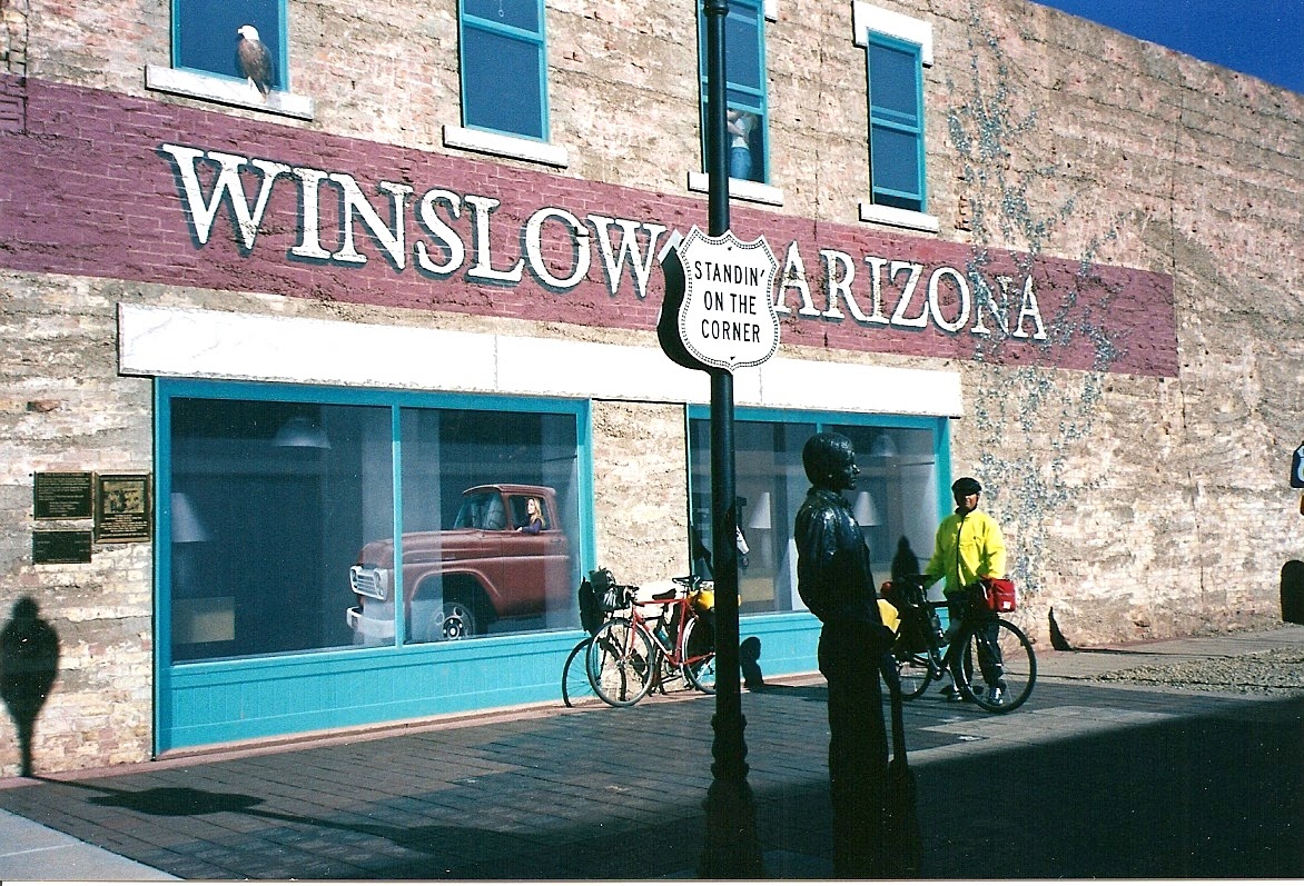
Finding a motel we were soon off for dinner at Alfonso’s. After dinner we were thinking what to do, then we decided why not “Standin’ on the Corner.” For those who do not know Winslow is famous for being mention in the song “Take it Easy” by Jackson Browne and Glenn Frey. Here are the lyrics to the song:
Well I’m a runnin’ down the road tryin’ to loosen my load
I’ve got seven women on my mind
Four that wanna own me, two that wanna stone me
One says she’s a friend of mine.
Take it easy, take it easy
Don’t let the sound of your own wheels drive you crazy
Ligthen up while you still can, don’t even try to understand,
Just find a place to make your stand and TAKE IT EASY
Well I was standin’ on a corner in Winslow, Arizona,
Such a fine sight to see
It’s a girl, my Lord, in a flatbed Ford, slowin’ down to take a look at me.
Come on baby, don’t say maybe,
I’ve gotta know if your sweet love is gonna save me.
We may lose and we may win, but we will never be here again,
So open up I’m climbing in
So TAKE IT EASY
Well I’m a runnin’ down the road tryin’ to loosen my load
Got a world of trouble on my mind.
Lookin’ for a lover who won’t blow my cover,
She’s so hard to fund.
Take it easy.........take it easy,
Don’t let the sound of your own wheels make you crazy
Come on baby, don’t say maybe,
I’ve gotta know if your sweet love is gonna save me.
Ooh ooh ooh ooh ooh ooh ooh ooh ooh ooh
Oh we gotta take it easy, we oughtta TAKE IT EASY
You can see in the picture that there is a statue of Jackson Browne as well as a mural showing the flatbed truck. Sorry for such a poor picture, we just could not wait long enough for the sun to light the whole scene. Also available, for a fee, you can stand on the corner permanently. Bricks in 3 sizes can be purchased, inscribed, and placed at this street corner.
(4-8 Holbrook) Today was like yesterday, cold and sunny to start and sunny and warm to end. Another landmark is just down the road. We made a stop at “Jackrabbit.” There is not much left, only a Trading Post, which is going as strong as ever. There’s a saying about Jackrabbit, “If you haven’t stopped at Jackrabbit, you haven’t been to the Southwest.” There are signs along the highway advertizing Jackrabbit and one at Jackrabbit that reads “Here It Is.” I think they make a mistake by not having the sign read “Hare It Is.”
Entering Holbrook we saw another landmark the “Wigwam Motel.” Since we missed being able to stay in a wigwam in California we decided to stay at this one. Again we found the place closed until 6 PM. So we rode on to the town center and found a motel. The problem was that we did not want to wait until 6pm to find out that the place was full or that they wanted $100 per night. Later we rode back just to see what the cost would have been. Again I was surprised to find it was only $40 and there was plenty of room. Next time.
We eat dinner at the “Plainsman Coffee Shop and Dining Room” another landmark. Holbrook’s Visitor’s Center is in the old county courthouse and well worth a visit. The old town was notorious for being one of the wildest, roughest towns in the territory until it was cleaned up in 1887. In 1887 Sheriff Commodore Perry Owens went to pick up one of the Blevins brothers for horse stealing. Within three minutes of his arrival, four of the Blevins were shot and three died. Another sign that law and order had returned to Holbrook. Another notable place in town is “The Bucket of Blood Saloon.” The saloon was one of the first rock structures built in Holbrook. It replaced a wood building destroyed in the fire of 1888, which wiped out the entire town. The notorious saloon was named for the violent brawls and shootings that stained its floors as well as its reputation.
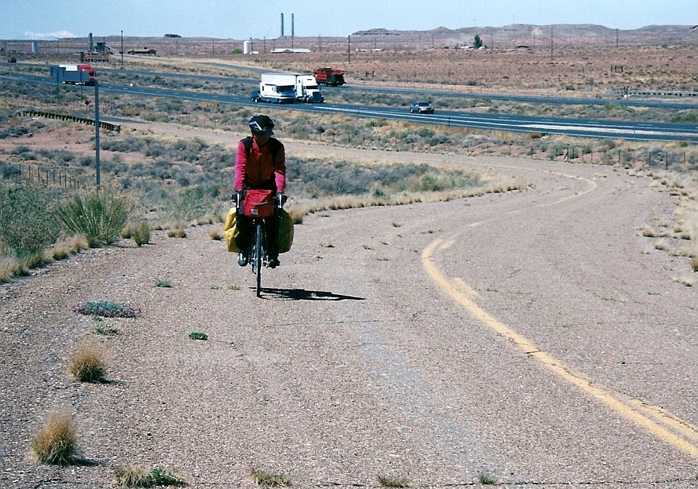
(4-9 Chambers) What else is new, the day started sunny and cold and turned sunny and warm. We made a stop to see the Petrified Forest and the Painted Desert. Here my “Golden Age Passport” pass got us in free. We did not see much of the Petrified Forest since it would have been 112 miles round trip to see it all. Lunch was at the visitors center was great. I had a BLT but most notable was the bottom-less root beer floats. You could get more root beer, ice cream or both. Which we both did. I think restaurant owners must shiver when they see long-distance bike riders pull up to eat.
Our overnight would be in the town of Chambers, population 450. As if we had a choice, since Chambers has the only motel between here and New Mexico. Yes, out here in no-mans-land was a Best Western (our most expansive overnight). Lucky for us it also had a restaurant. There was not much more in the town of Chambers besides a post office.
(4-10) Weather - same-o-same-o. I am not complaining, as it’s really pretty nice riding weather. We are still riding on the high Plato’s of AZ and NM. Our overnight would be in Gallup, New Mexico. We have been climbing little by little and will be at 6,500 feet in Gallup. But first we had breakfast in the town of Sanders, AZ. at the Route 66 Diner. No it’s not a chain but there are just a lot of Route 66 Diners. The diner was in a big trailer.
The odd thing about Sanders is that post office is on a time that is 1 hour earlier than the rest of the town. So I guess if you worked at the post office you can have your hour lunch at noon and then go outside at take another hour lunch at noon.
We are now riding on the Navajo Reservation. The Navajos are the largest remaining Native American tribe, occupying a reservation, are some 150,000 people. We crossed into New Mexico and stropped to take our usual “Welcome to” picture. The wind today was what we call a “switchie” wind. First it’s in you face then it’s form the side and then from the rear and so on.. It just could not make up its mind. Gallup, our overnight, was just ahead.
We rode 7.5 day in Arizona coving 477 miles with 15,770 feet of gain.