Lewis and Clark Bicentennial
This year I took the bus to the start (Boardman) and Lois picked me up at the end (Astoria.) The idea for this years ride was to follow Lewis and Clark’s route as close as possible. Cycle Oregon threw in a couple southern swings just for the fun of it. Other wise we would have just ridden along side the Columbia River all the way to Astoria - kind of boring and without many hills. I am sure by now you know how much Cycle Oregon loves hills.
My miles were higher than Cycle Oregon had planned, as I wanted to reach 600 miles for the week, so I rode a few extra miles almost everyday. You could have ridden as little as 432 miles if you did not ride the option and did not ride at all on the layover day. Or as much as 516 miles if you rode all the options. I rode 603.9 miles, a record for me. My previous high was 586 on Cycle Oregon 9 (1996) which had three century options, all of which I did.
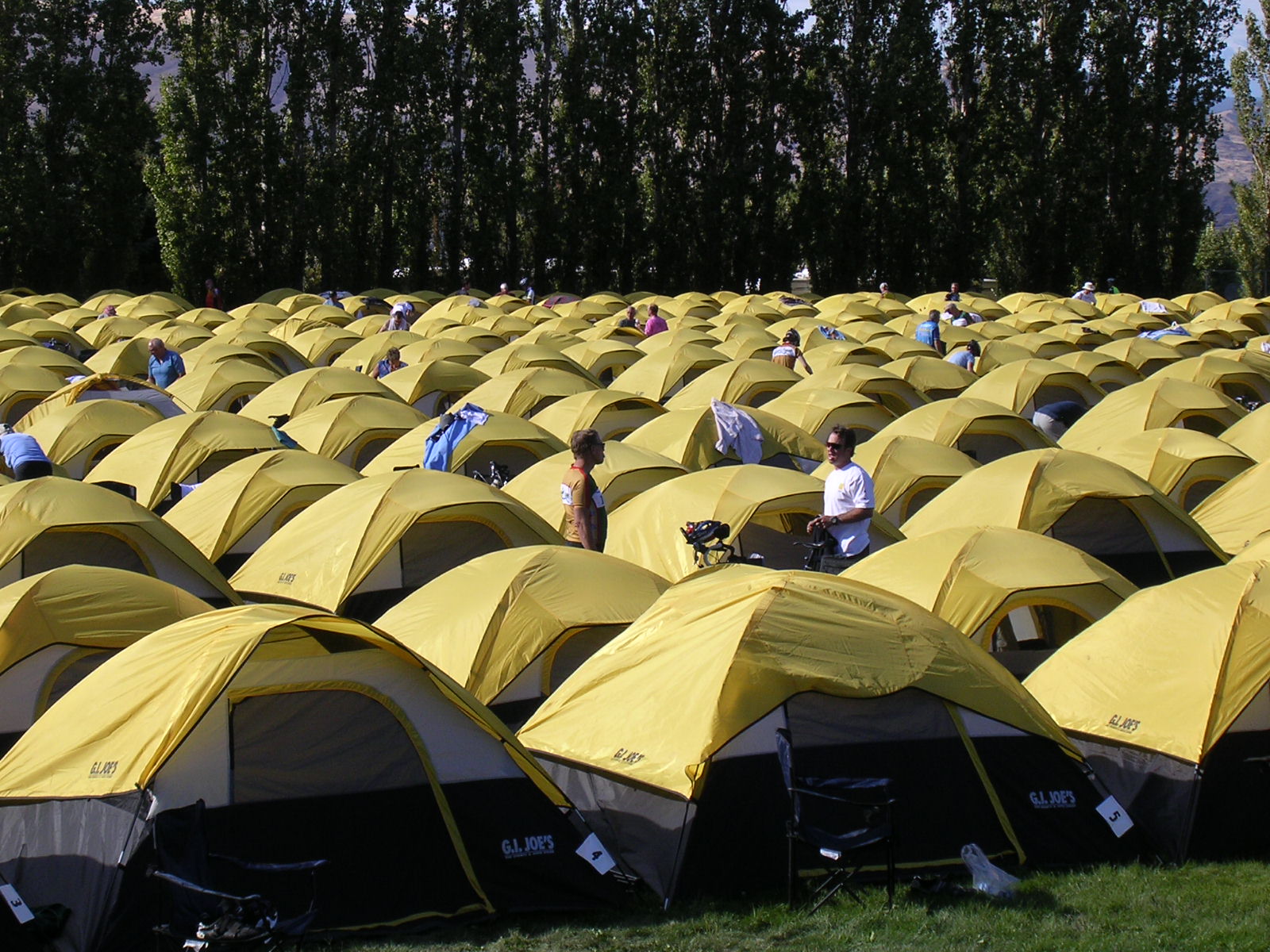
Why was it easy for me to ride more miles this year than in passed years? Three years ago Cycle Oregon introduced a new option, for a extra fee - “Joe’s Outdoors Tent & Porter Service.” “Joe’s refer’s to “G. I. Joe’s” a local outdoor and auto store. Imagine this: On arrival at camp, instead of having to find a campsite, than heading to the baggage truck to sort through hundreds of bags looking for yours and hauling it to your site and setting up your tent, you head directly for a shady grove of trees where a Cycle Oregon tent has been set up for you. Waiting inside: your bag!. In the morning you just pack your bag and get on your bike (after breakfast). My guess is that I save about 1.5 hours in the evening and 1 hour in the morning, giving me more time on the bike. The first year they was 200 tents, the second 300 tents and this year there was 500 tents.
Because of this not only did I ride more miles I spent a lot more time stopping to talk to people along the way, sightseeing, and picture taking. This was the most leisurely Cycle Oregon I have every done.
Riders who came from other states sure got a great look at Oregon. Our route took us out across the high deserters of Eastern Oregon, down to the John Day River and up the other side, along the Columbia River, a stop at the Rowene overlook and on through the Rowene Tunnel on the Old Columbia Highway, on the Old Columbia Highway passed all the water falls including Multnomah Falls, up to Crown Point overlook, a great option to climb Larch Mountain, through the rolling hills of the western side of the Cascades with wonderful views of the local mountains including Mt. Hood, along side the Clackamas River, out across the Willamette Valley to Champoeg State Park (the birth place of Oregon), lunch at the Oregon Gardens, through the forest of the eastern side of the Coast Range, and finally along side the Nehalem River with a stop at Fort Clatsop (were Lewis and Clark Wintered) and on to Astoria, where we climb to top of the Astoria Column with it’s great views of the city and the Pacific Ocean. What a wonderful ride.
Day-1 My miles = 87.5 (CO miles = 81) Boardman to Condon.
Cycle Oregon usually has a first day which is on the easy side, but not this year. This was the hardest first day in the history of Cycle Oregon. Not only was the mileage long but we had 6100 feet of elevation gain and some headwinds. The day was just one long hill, or it sure felt like it. Our campsite at Boardman was on the banks of Lake Umatilla (part of the Columbia River), it was a great place to camp. I must admit there was a few trains that passed through during the night.
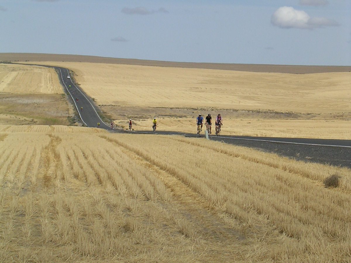
While riding along I saw a over weight looking motorcycle rider sitting on the other side of the road next to his very nice motorcycle. I stopped to talk to him (no one else had stopped). My usual opening line with motorcycle riders is “would you like to trade bikes for a few miles.” He laughed and said “I should.” He then told me that he had ridden 5 Cycle Oregon’s (#2, #3, #4, #5 and #6). He went on to tell me that he rode a motorcycle until he had kids, then sold it and started riding a bicycle for awhile. After the kids were grown to went back to riding a motorcycle. I am sure I am the only one of the Cycle Oregon riders who knows his story.
In Condon we camped on the golf course (the greens were roped off). On hard riding days my first stop after reaching camp is at the “Recover Smoothie” stand. This guy travels with us, making and selling his Smoothie. It’s a mixture of a bananas, strawberries, pineapple juice and protein powder (I think I am missing several ingredients). They sure hits the spot.
Day-2 = 78.6 miles (CO miles 71) Condon to The Dalles.
When I woke I checked the temperature inside my tent, is was 42 degrees, meaning it was in the 30s outside. We had enough hills at the start to keep me warm. Even with a profile that looked like the day was going to be mostly downhill we still had 3332 feet of elevation gain. The downhill to the John Day River was a screamer. Again we had headwinds for most of the day, we rode east to west. It was reported that there was an outbreak of “skinny-dipping” in the John Day River. Of course the first law of skinny-dipping is: It’s never the people you’d like to see skinny-dipping who actually skinny-dip. So I guess I really did not miss much.
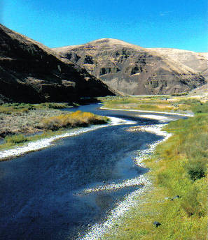
It got warmer as we rode and soon I was in a bike jersey and shorts, my favorite way of riding. After lunch in Wasco we headed down to the Columbia River where we encounter some 20 miles into a pretty good headwind to our overnight at The Dalles. We camped high about the river at Sorosis Park with a great view of the mighty Columbia in both direction and the city below. Tonight's entrainment was the “Oregon Trail Band.” In years passed they were a smash hit, this year while very good they seem to lack something. I think they tried to hard to incorporate the Lewis and Clark theme.
Day-3 = 77.7 miles (CO miles 68) The Dalles to Roster Rock State Park.
Today was one of those very special days, with lot of nice surprises. We could have ridden all day on Interstate 84 to our overnight at Rooster Rock State Park but instead we had many miles of the Old Columbia Highway and bike paths. I have ridden through the Columbia River Gorge many times and never knew there was so many bike paths. Those of you who have visited the Columbia River Gorge know how beautify it is, with waterfall after waterfall. I heard an out of state rides say “wow another waterfall.”
Reaching our overnight some 200 of us found our first problem with the “Joe’s Tent” service. They put us in a dusty field that was marked “dog walk area” and with no shade, and a long ways from everything else. Also we were right next to Interstate 84. When I asked one of officials why we were put there he said “there was no room left in the shaded area” where the other 300 tents were. I told him to look over his shoulder at the shaded area, where there was tons of room. Some of us just picked up our tent and moved to the shaded area. He came back later and said “a big mistake was made and we should not have been put in such a bad place.” He sent back some of the volunteer help to help those who wanted to move. Those who had already unpacked their bag and did not want to move were given tickets for two free beers. I thought about moving back - just kidding.
Another downer, not Cycle Oregon’s fault, was that the passing 18-wheelers found great delight in blowing their loud air horn as they passed the campsite. Since it kept up ALL NIGHT I am sure there was CB Radio contact between them that let them know we were camping next to the road. How else would they know in the middle of the night that we were there.
Day-4 = 102.6 miles (CO 71 or 99 if you rode the option) Roster Rock State Park to Champoeg State Park
Today was the big day, the option to climb Larch Mountain. If you did not ride this option you had 3410 feet of elevation gain and if you did you had 6725 feet of gain. The profile made it look really challenging and scared most of the riders. Only about 80 or so took the challenge. The night before I was talking to a group from Chico California about this climb and suggested they give it a try, they did and really enjoyed it. If you have ever ridden or driven this road you know that it’s only about the last 5 miles (the climb is 14.5 miles long) that is a steady climb. The ride down was VERY COLD as it was in the shade most of the way. The shade also made it hard to see the rough places in the road, so I just took it easy (many went flying by me).
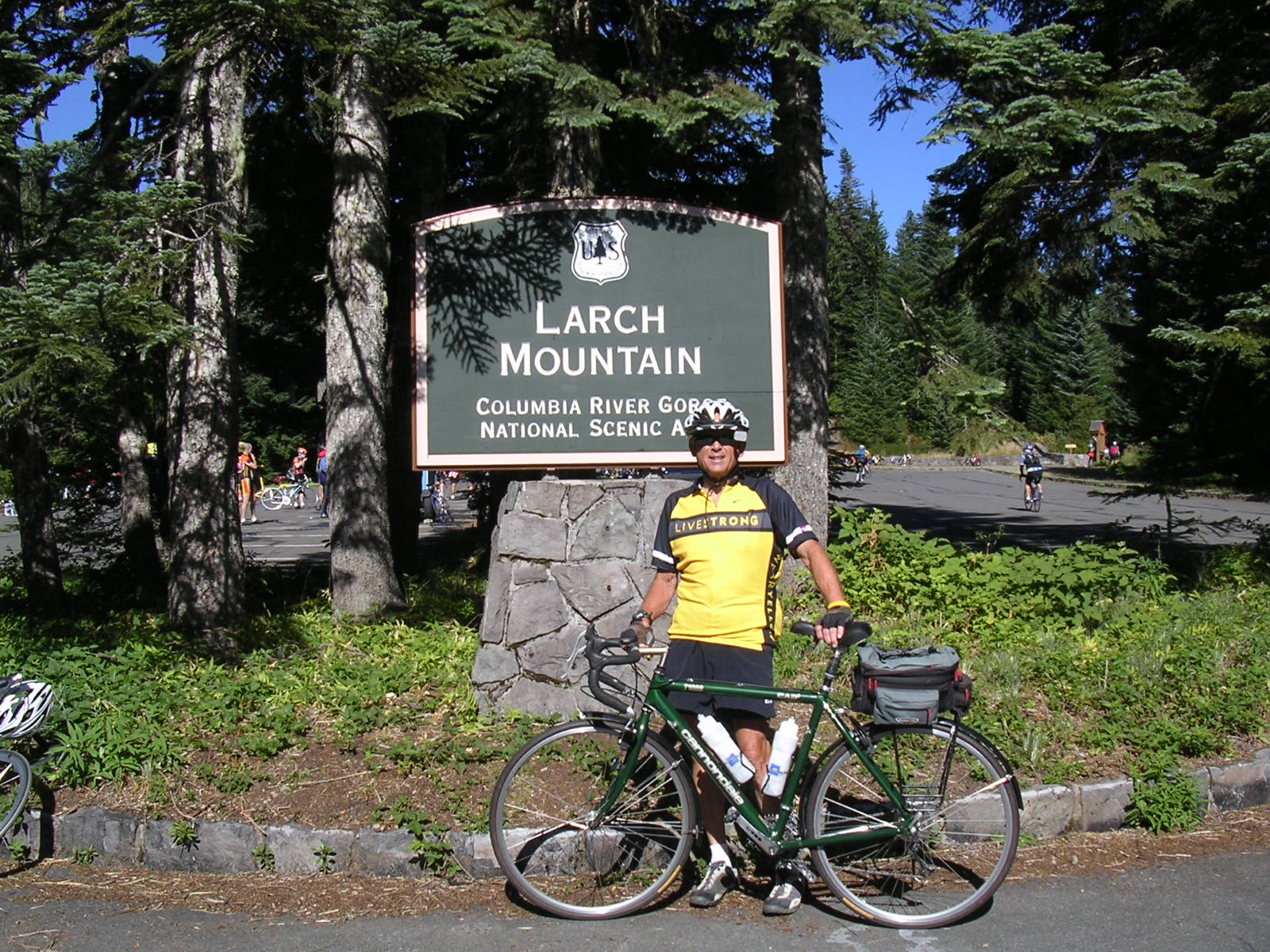
It was interesting that the hills later in the day, while not as long, were much steeper. One hill of about 1.5 miles was said to be a 16% grade. Along the way there was a person handing out bottle water for free and one person who left out a bowl of candy for the taking. It did feel great to reach the Willamette Valley, with it’s flat roads and warm temperature. Our overnight was at Champoeg State Park, where on May 24, 1843, Oregon’s first government was formed. Have I said “life is good.”
Day-5 = 90.3 miles (Layover Day CO miles 0 to 56) Champoeg State Park
Today was the layover day. 500 of us rode the Oregon Gardens where lunch was served , 500 rode the 3 miles to Buttville for ice cream and the remaining 500 just hung around camp. There was plenty to do in camp, hot air balloon rides, canoe rides, wine tasting, and other things that have left my memory.
For me it would be a great day as I know the area very well. I followed the Cycle Oregon route to lunch at the Oregon Gardens. After lunch I walked around the gardens a little. I had read in the paper that they are hurting to make a go of the place. While I must say it’s a very beautify gardens I must also say when I am on my normal ride around my valley (The Tualatin Valley) I often ride by homes and farms with just as beautify gardens. My thinking is that the Oregon Gardens can only make a go of it from tourists and not from locals. The gardens are not well located for tourist travel.
Leaving the gardens I saw a sign that read “Salem 15 miles” so that is the way I went (leaving the Cycle Oregon route). Reaching Salem I then headed north on I-5 which was a treat for me since when I usually ride I-5 it’s north to south. As any of you know who ride I-5 you can have an effective tailwind going in either direction (due to the high flow of traffic - mostly the trucks). Knowing that the Cycle Oregon route back to camp went through the town of Hubbard I rode to the first exit north of Hubbard and then found my way back on to the route. I had a wonderful ride just taking my time and cursing along. Every night at 7:30 there are announcements, next days route and weather among other things. This night rain was in the forecast for the next day. If it happened it would be our first rain of the ride (last year we got wet 6 of 7 days with one day of snow and hail)
Day-6 = 86.1 miles (CO miles 68) Champoeg State Park to Vernonia
When I woke and looked out of my tent it was cloudy but not raining. I packed up, went to breakfast and returned to my tent to get ready to ride. By the way these Joe’s tents are big enough for two and since I was one I had plenty of room inside for me, by bag and my bike.
Just as I took the bike out of the tent the rain started. Being a “bike tourist” I have full water-proof rain gear, which I put on. It rained on and off all day, not supper heaver but just enough to get the streets and you wet
After lunch in Varboort, Cycle Oregon took us up one very steep hill. If you remember I mention earlier how much they like hills, today was no exception as they took us up Chapshaw Hill Rd, that could have been easily avoided (of course I knew this but most of the other rides did not since they don't live in the area as I do). Today’s ride had 3020 feet of elevation gain. As I always say “It’s just another hill in life and probably won't be the last one.”
Arriving at Vernonia, our overnight, the rain for the most part had stopped and we began to dry out. There is a bike path (it’s really what they call “Rails to Trails”) that runs from Vernonia to Banks. I have ridden on the Banks end which is paved for the first 5 miles before it turns into gravel. The Vernonia end is also pave for some distance, but I did not know for how far. So I just started riding the path. I found that this end is paved for 7 miles before it turns into gravel.
Funny, this being our last night in the “Joe’s Tent” they put is in the best location right in the middle of everything. The probably wanted us to leave with a good memory. It was very very nice not to have to mess with all that it takes to set up and take down a campsite - yes, I would use this service again.
Day-7 = 81.1 miles (CO miles 73) Vernonia to Astoria
Our last day. There was no rain but we did start in a heavy mist that made you wet and cold. This would be another fun day due to riding a good part of the “Hood to Coast” running relay route (which I have run in the past). The first town we passed through was “Mist” kind of appropriate. It’s very common to have the early morning mist in this area since we are in a narrow valley following the Nehalem River. On Cycle Oregon 4, day 2 was from Vernonia to the town of Nehalem and we had the same kind of mist on the ride.
The route was mostly downhill, although we had 1929 feet of gain, one long hill. After making a food stop at Fort Clatsop we headed to Astoria. Everyday Cycle Oregon had water stops at about 10 miles intervals and food stops at about 20 mile intervals along with a lunch at about the halfway point. Of course at all stops there were “Blue Rooms,” Cycle Oregon’s name for porta-potties.
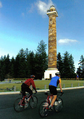
Cycle Oregon had one last surprise for us, so up the hill we went. It was a tough climb due to all the traffic on this narrow road to the top. Reaching the top I got off the bike and made my way up the 166 flight of stairs to the top of the “Astoria Column.” It was well worth the effort as the view is spectacular. Lois was there waiting for me and after loading to bike in the van we headed for Seeside for the night.
There is no question that the ride turned out to be more interesting then first though. I am sure many local riders did not ride this year due to what they though was going to be a boring route - meaning that we were within 25 or so miles on home for 4 of the 7 days. Also we have covered some of the same roads on past Cycle Oregon’s. I made a lot of new friends and was happy to see some from the past. While I rode alone I was never alone.
Some Stats.
Number of riders = 1601 (down from the 2000 to 2200 in past yeas)
Riders male = 1153 (72%)
Riders female = 448 (28%)
Vegetarian riders = 9.9%
Average age = 48
Oldest rider = 80
Youngest rider = 6
Number of States represented = 38
Number of Countries represented = 6
My fastest MPH = 42 (many went faster but with age one gets wiser)
My longest day = 102.6 miles
My average miles per day = 86.3
Flat tires = ZERO
Rainy days = 1
Starting weight = 148.8 pounds
Ending weight = 149 pounds
Cost = $750 plus $250 for the porter service
If you remember last year at this point in my trip report I wrote about the nice things Cycle Oregon did for us. This year I must write about the not so nice things they did. The new daily route maps were useless, hard to read and the wrong size The Joe’s Ported service, while great on most days, was poor on some days, meaning my tent was out in the hot sun, a long distance form everything, my bag was dumped upside down (breaking the plastic coffee cup I had), and one day there was no chairs at my tent site. Several times they ran out of food items as well the variety of items at the rest stop sucked - meaning the selection of energy bars was very poor. I think they tried to cut cost, since the number of riders was down. In year passed they provided a small plaques, which looked like license plates, that you could attach to the back of your bike with your name and hometown on it, making it a more friendly ride - this year no plague.
In passed years Cycle Oregon gave you a small dog-tag for completed the long option ride, almost always a 100 miles. Even in 1996, when we had 3 century options they gave us 3 dog-tags. This year after riding the long option and not receiving the expected dog-tag I stopped to ask a Cycle Oregon official if they have stopped giving dog-tags. After same conversation she said “you will get a dog-tag.” I said “there are no more centuries to ride.” She said in a pretty sarcastic tone “centuries are important to some.” I now wonder if she meant that riders who centuries are important to are not important to Cycle Oregon. I wonder if she ever rode a century and knows how good it feels to finish your first one. On this Cycle Oregon as well as on passed ones I have helped others ride their first century. Note: I had thought that this lady must be a volunteer but after watching the DVD(of this years ride) that I bought and seeing this lady up on stage I now realize that she is not only a CO employee but is probably the head person - it’s really to bad she feels this way. With this kind of attitude there are better ways for me to spend my money.